Examining the area of the Metropolitan City of Milan we focused on big infrastructural nodes, which tend to design the territory incisively. These specific existing tangles of lines of fast transportations shape the space of these areas which don’t communicate anymore neither with the natural territory nor with the urban patterns. The aim of the project is to redesign the New Gates of the city, to reshaping the spaces which characterize them and to convert these spaces of motion into spaces of stop, of life, of contemplation.
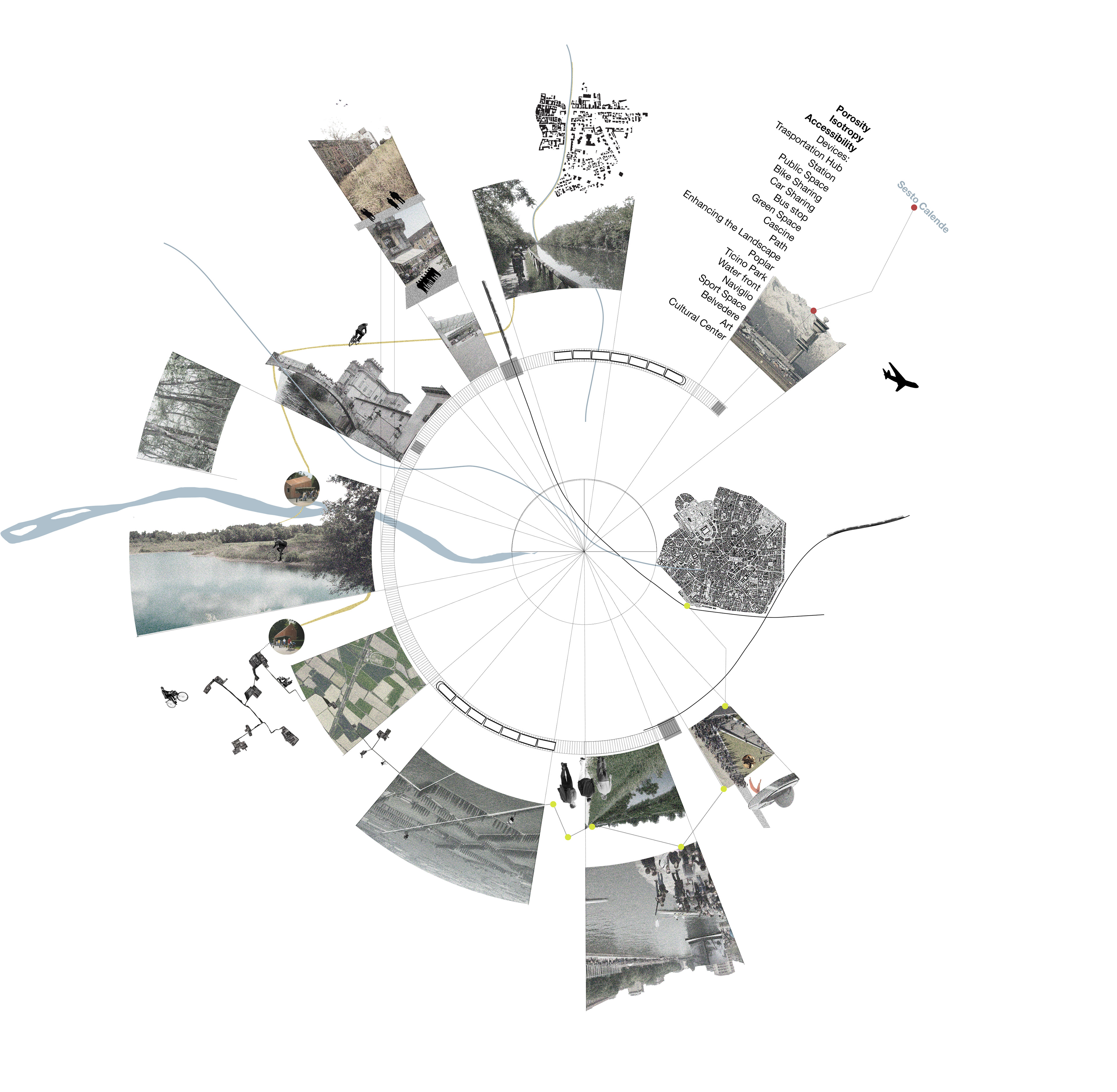
Distinguishing the slow transportation network and the fast one, we tried to sew them up to reconnect the two different system in order to give an easier accessibility to the territory and a different perception of the crossed spaces. Managing the interface as a fragmented device widespread on the territory occupying a large area, instead of a single limited point or a shape, it’s possible to reactivate entire areas and also to make readable the difference between inside and outside the city giving a new texture to the entire external tissue of the Metropolitan City of Milan.
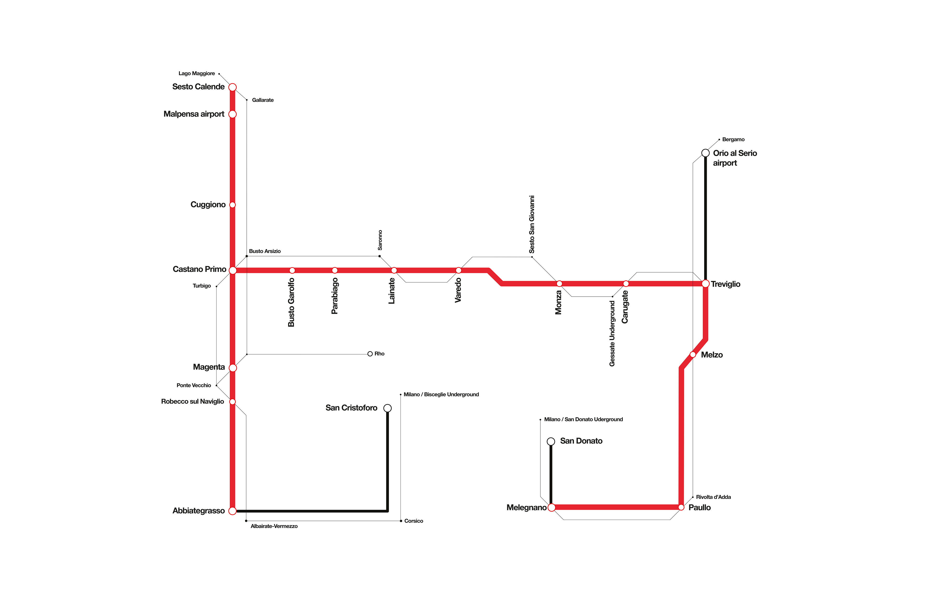
Considering Ticino and Adda rivers, we focused on another intervention: a light train, which complete the existing network giving the possibility of a public transport along the river and reconnecting the different areas, cascinas or urban tissues, closer to the rivers. Considering TAV system, the railways and the highways as fast trasportation, we chose to use the existing bike paths and pedestrian paths as a slow short-range connection useful for both the linking of the diffused transportation interfaces and the connections between the different functions.
01
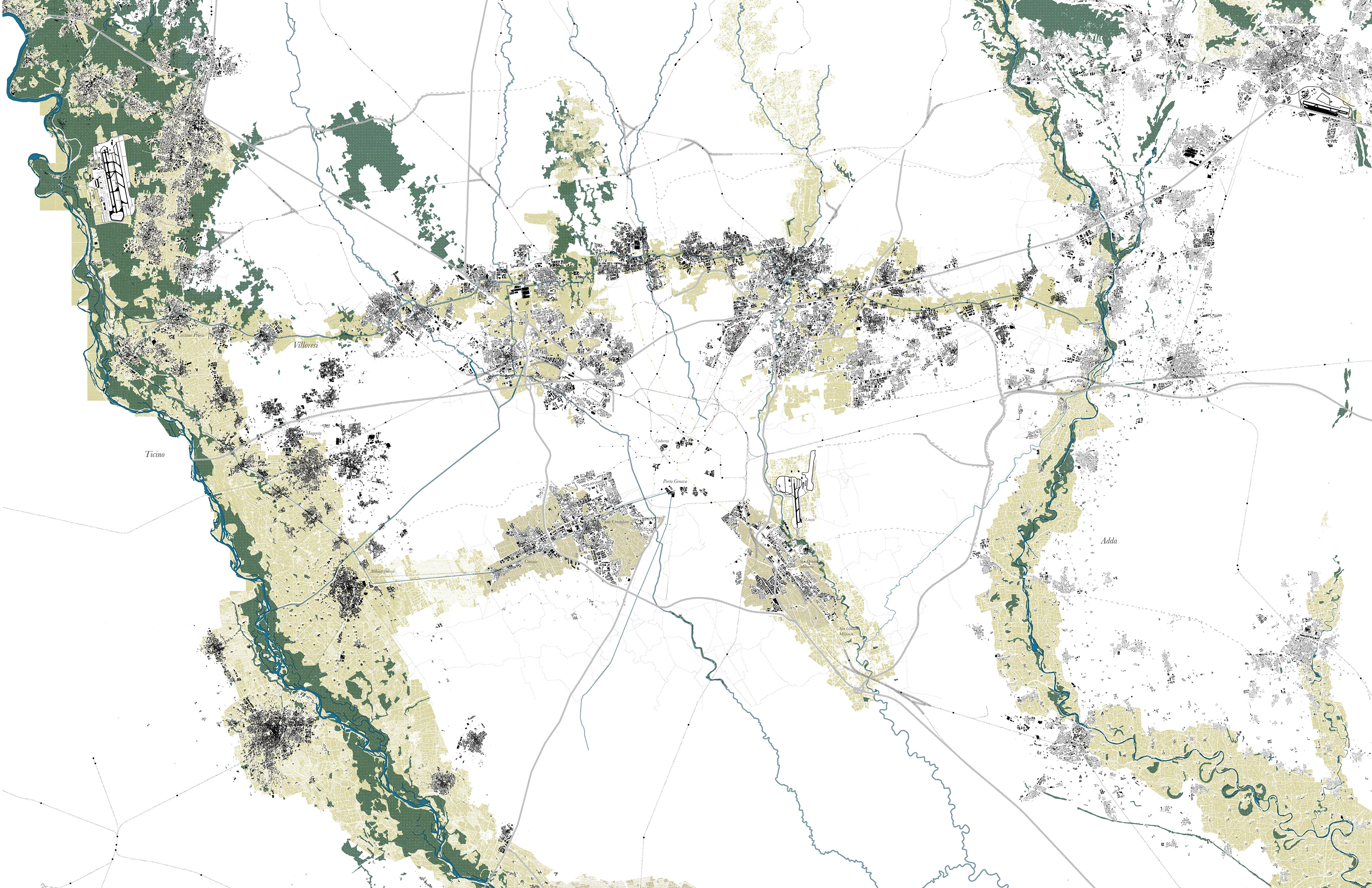
Interpretative map
02
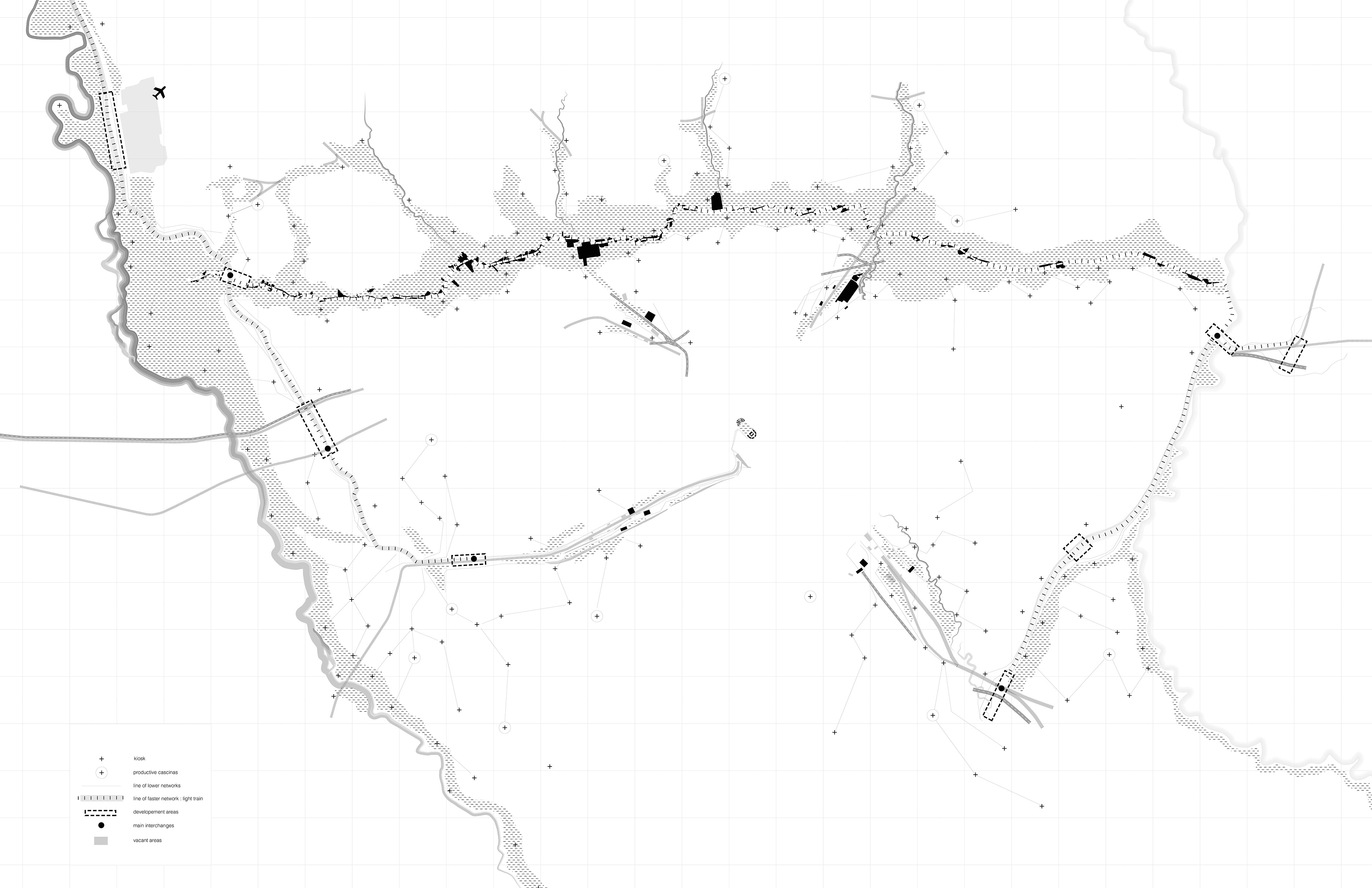
Strategy map
03
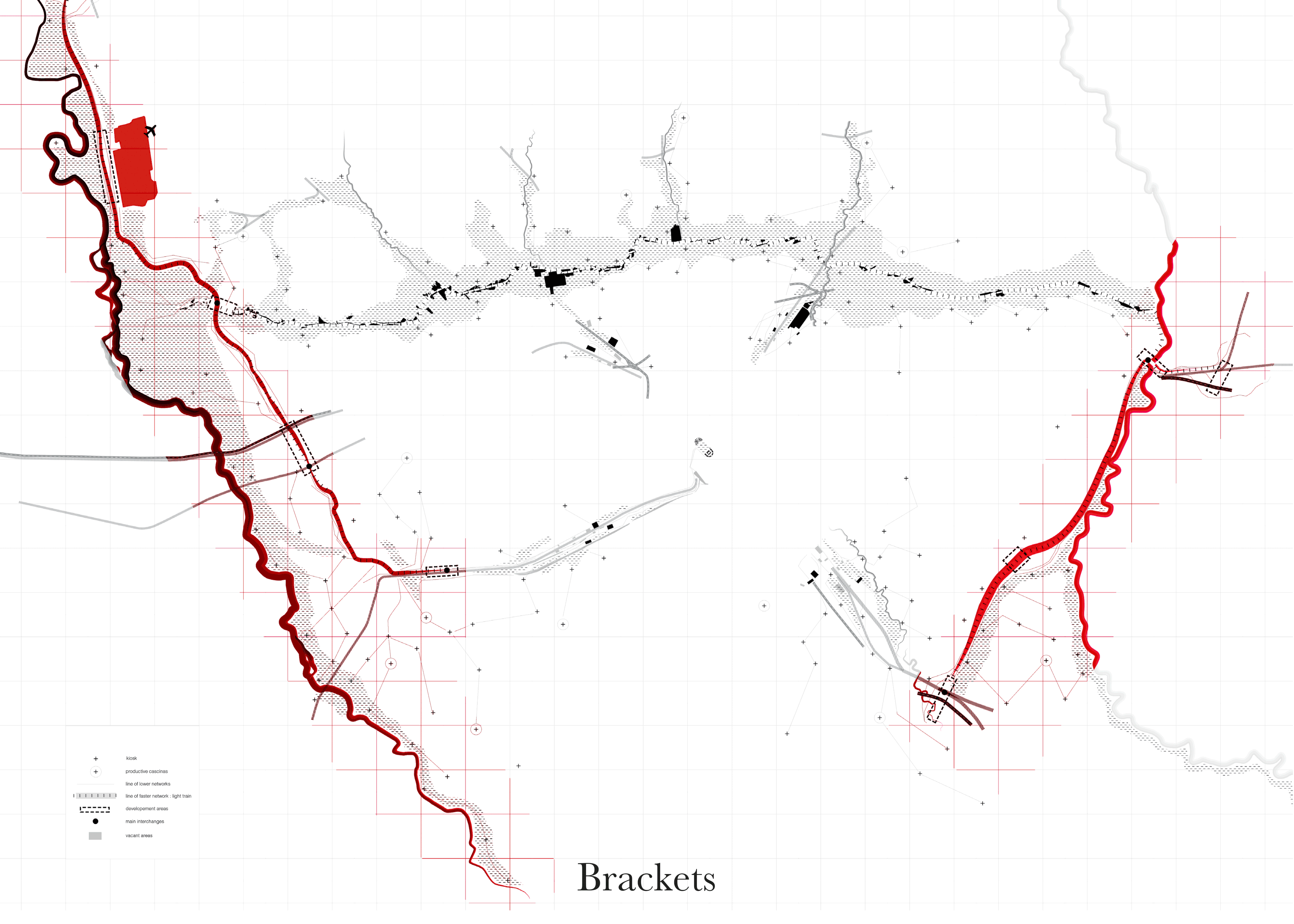
Strategy map. Brackets, Doors, Villoresi spine
04
Light Train Line
Weakness
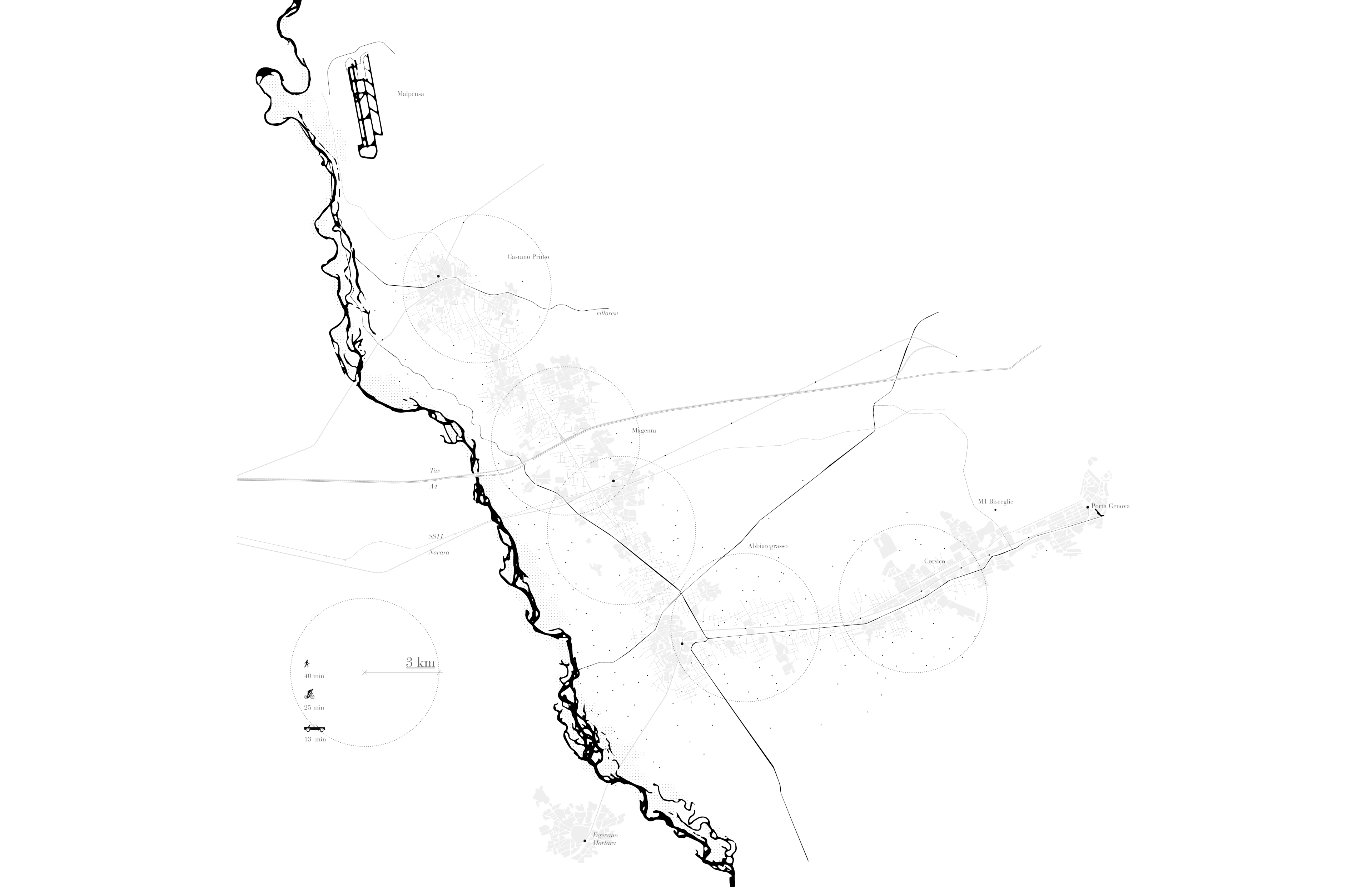
Weak interchange system between big infrastructures. Weak connections based almost exclusively on the private car transport. Weak public trasport based only on a single bus line. Weak connection between the natural environment, the Parco Agricolo Sud and the Ticino Park, and Milan. The public transport doesn’t give the possibility to enter in to the slow teritory, characterized by cascinas and agricultural fields.
Potential
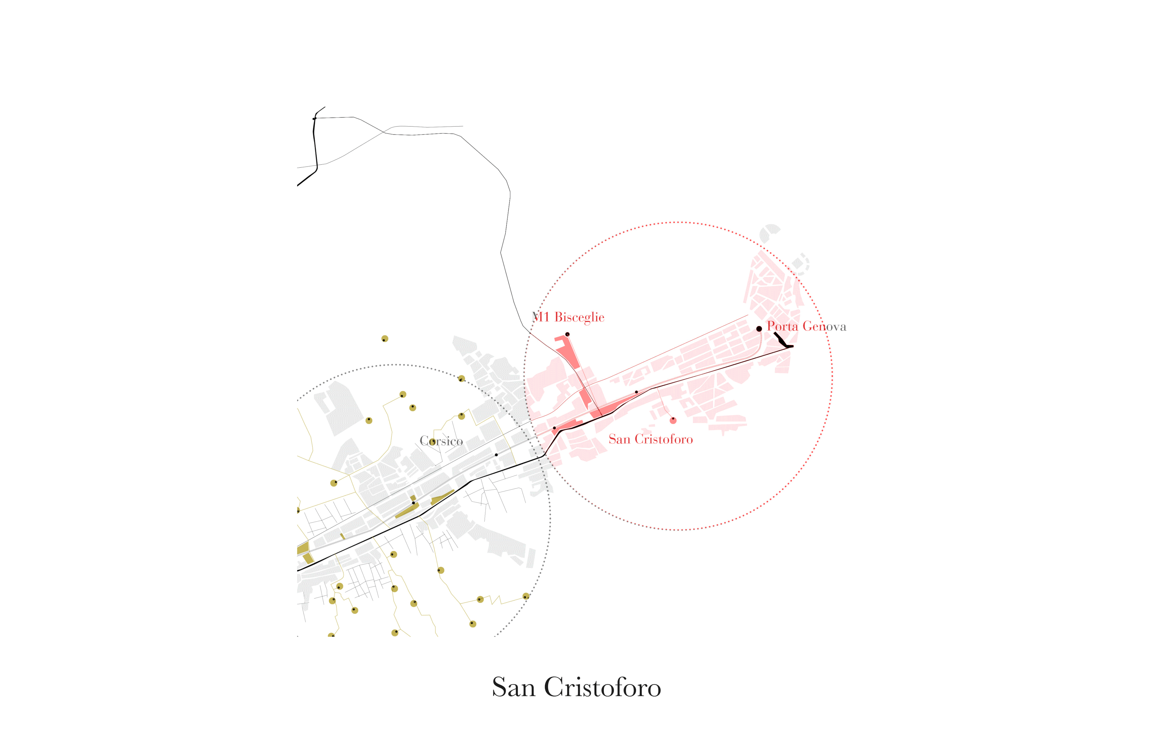
The very dense existing system of small streets and path could be used as the way of a new mobility. The irrigation ditchies could create a network of path harmoniously crossing the landscape. The agricultural sites, such as cascinas and farms, could become recreational and receptive spaces. San Cristoforo could became a new door of Milan overlooking at the natural scenery. The accessibility to the territory could be increased dealing with a new set of infrastructural connections. The accessibility could be improved by a more efficent trasport system based on the creation of new interchange poles.
Design Advantages
Possibility to increase the accessibility to the territory of Metropolitan City of Milan. Possibility to strenghten the public trasport. Possibility to connect Malpensa and Abbiategrasso with the new tram line, Abbiategrasso with San Cristoforo thanks to the existing railway and to connect San Cristoforo with Linate Airport with the new M4 Underground line.
05
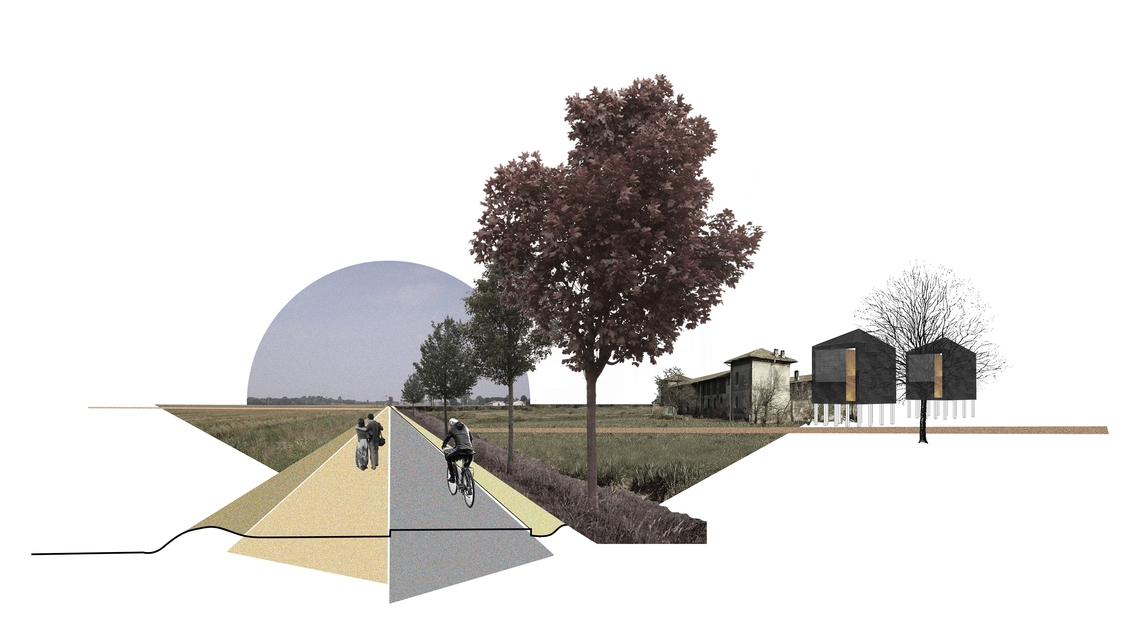
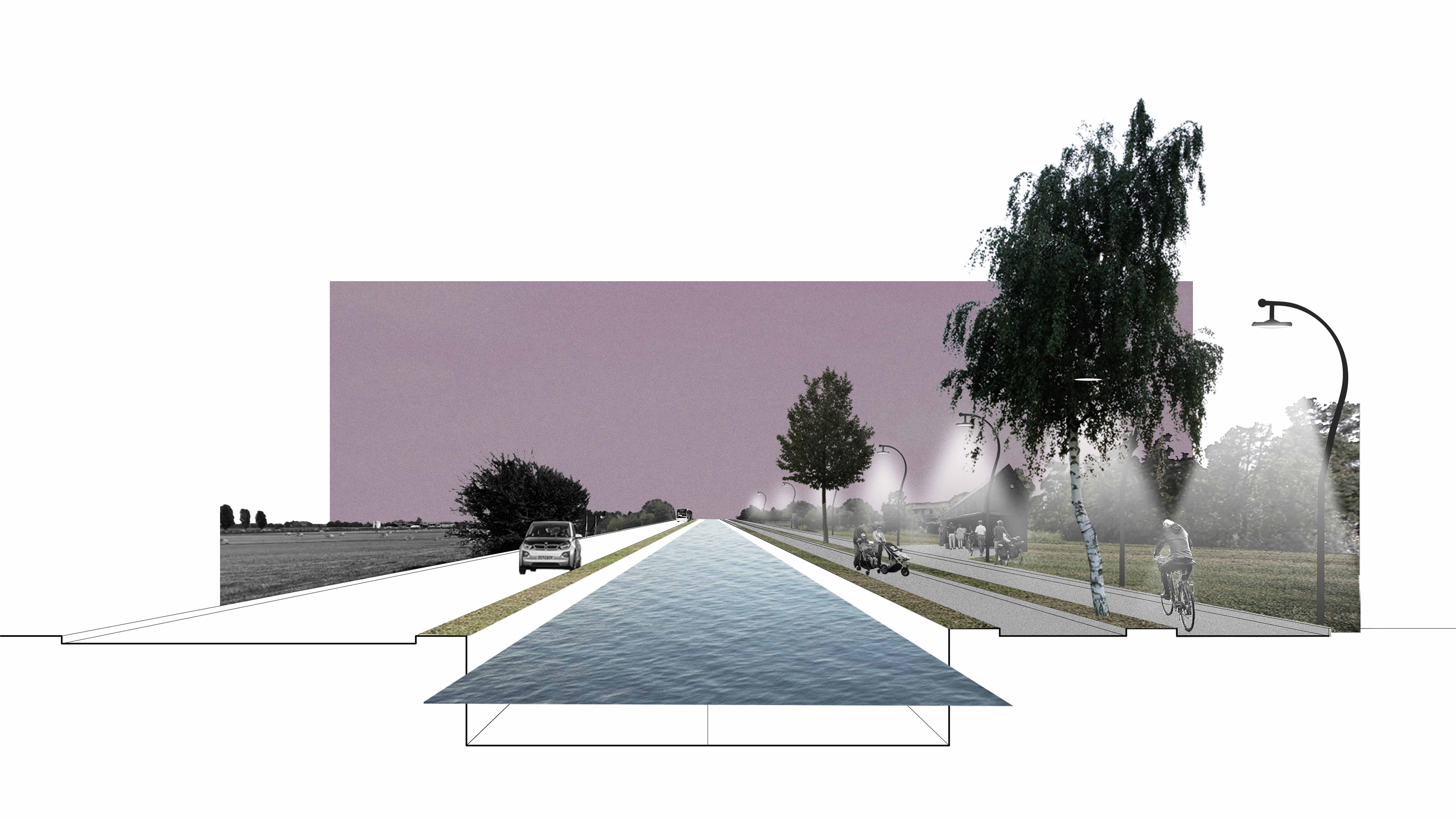
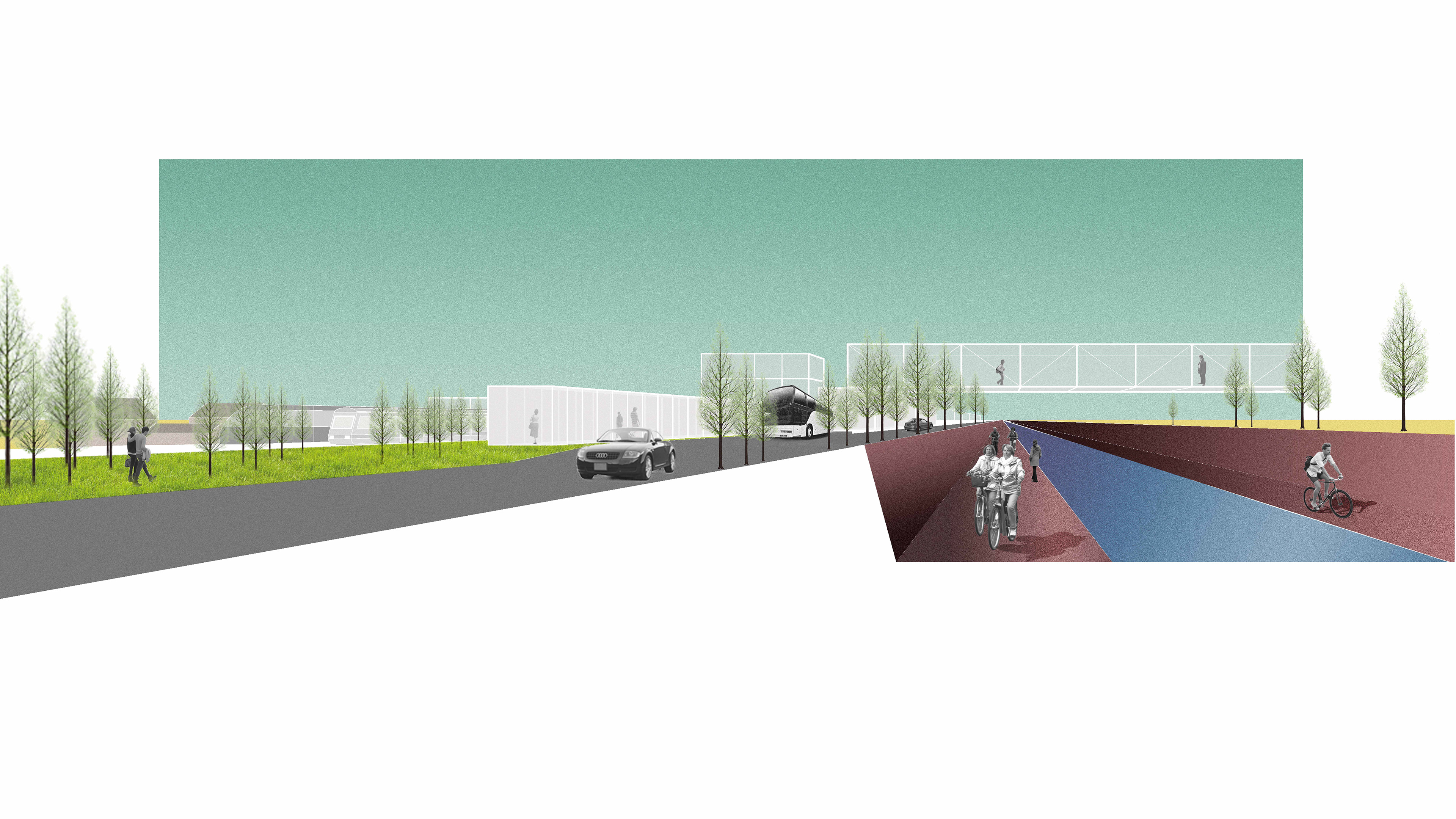
Transect
06
Zooms on transect
07
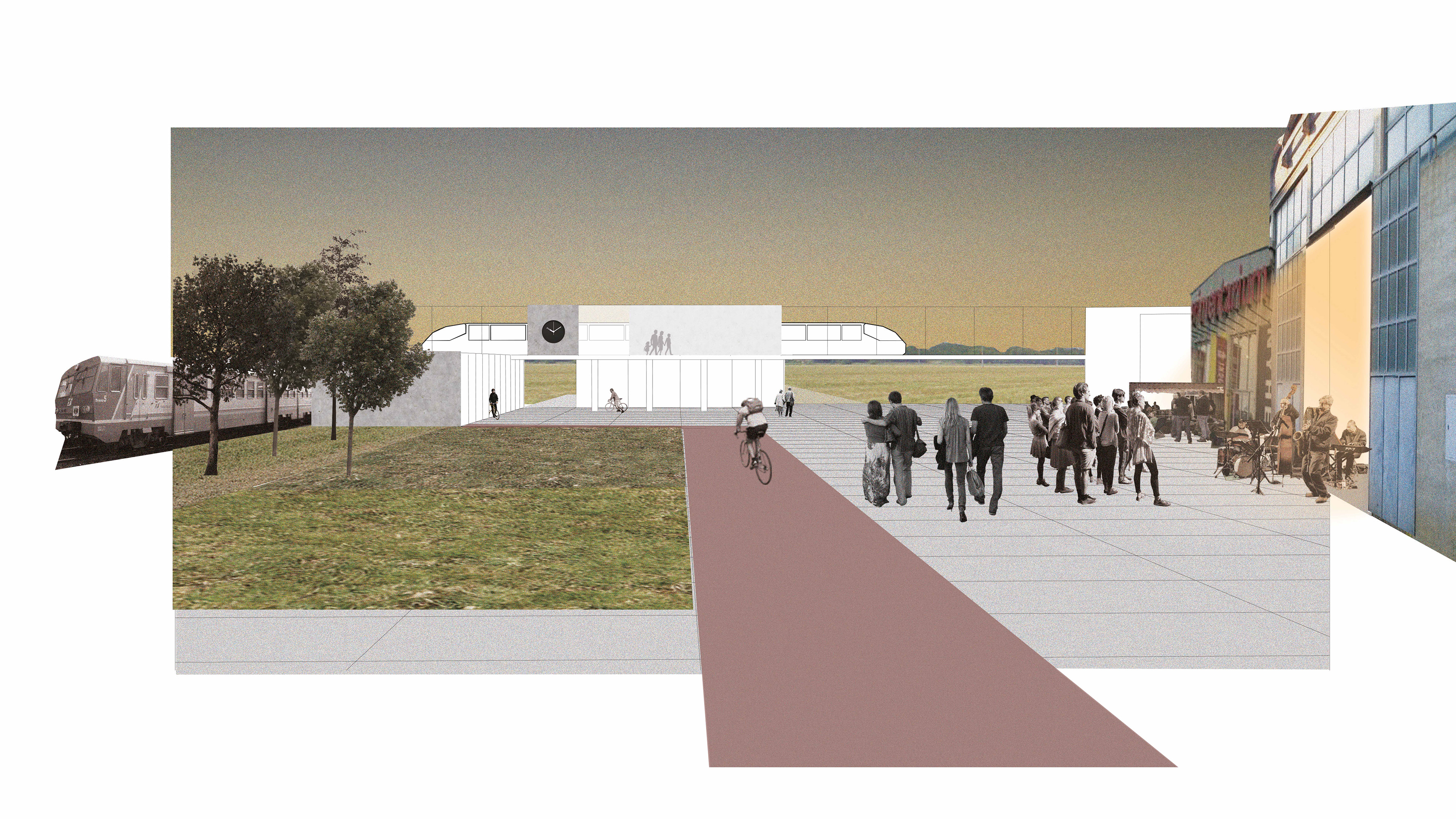
Scenario

Academic Project
Town Planning Design Workshop
Project topic Milano Horizontal City
Location Metropolitan area of Milan
Year 2015-16, october/february
Mentors Nicolò Privileggio, Stefano Di Vita,
Fabrizia Berlingieri
With Giulia Crotti, Diego Oberti,
Margherita Pascucci